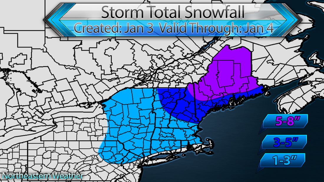
Low pressure will travel west of New England Saturday, with a secondary area of low pressure forming just off the coast. The secondary of low pressure will keep cold air locked in at the surface for areas west of Burlington, Vermont, with warmer air riding in above the surface. This will cause snow to change to a mix of sleet and freezing rain before changing over to rain for much of the area. Here's my snowfall map: *Short Post*
 RSS Feed
