A late-fall storm is expected in the Northeast beginning Friday, with the highest impacts being felt along coastal New England. Instead of breaking down the forecast day to day, I'll break it up into impact-based sections, which will cover Rain, Wind, and yes, Snow.
RAIN
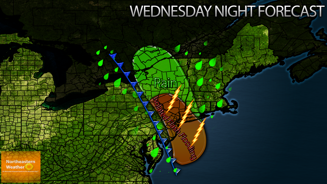
Since rain is not expected to be the main feature of this system, with most areas receiving less than 1 inch, I went against making a map for it. However, a few downpours could be enough to cause poor drainage flooding, especially over coastal Northern New England and most of Southern New England.
WIND
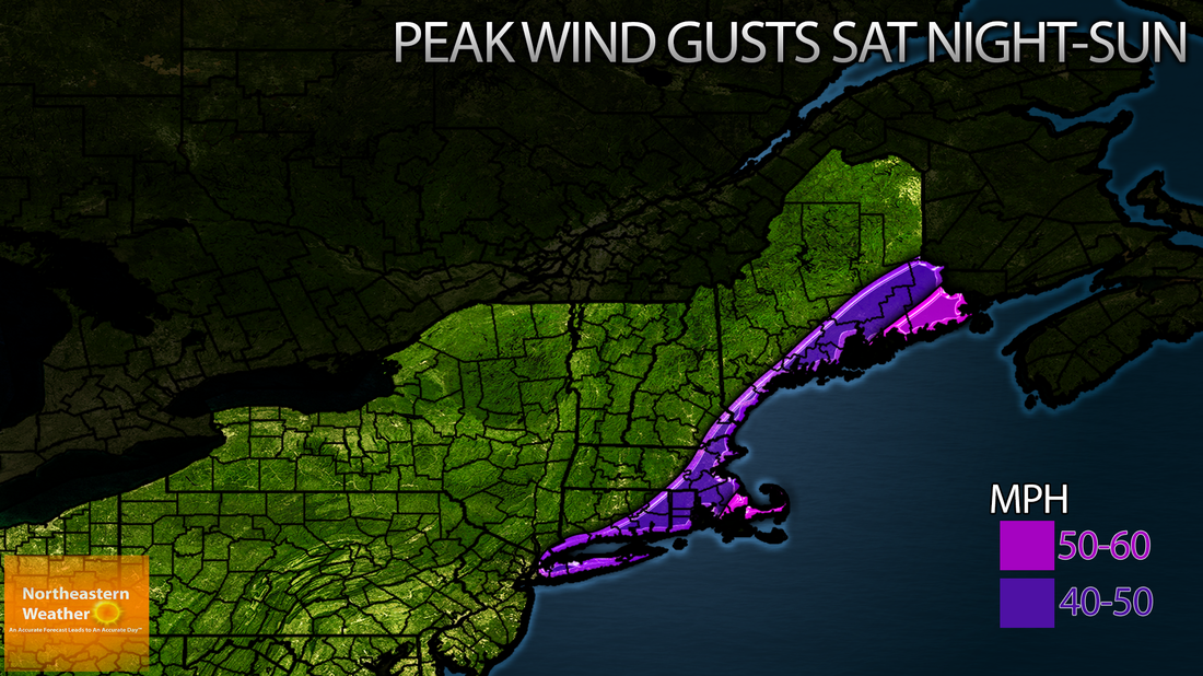
Wind will probably be the biggest issue with this system. There will be a huge pressure gradient with this system, and this combined with gusty winds behind a cold front will lead to some pretty hefty gusts. My current thinking is that gusts of 40-50 MPH will be possible for most of Downeast Maine, all of the coast of Maine, and eastern southern New England. 50-60 MPH gusts will be possible over coastal Washington county in maine and Cape Cod and the Islands of Massachusetts. This could change depending on the strength and track of the storm, so stay tuned! Here is a map of my highest wind gusts thinking for now. Highest winds should be Saturday night into Sunday for most.
RAIN
Since rain is not expected to be the main feature of this system, with most areas receiving less than 1 inch, I went against making a map for it. However, a few downpours could be enough to cause poor drainage flooding, especially over coastal Northern New England and most of Southern New England.
WIND
Wind will probably be the biggest issue with this system. There will be a huge pressure gradient with this system, and this combined with gusty winds behind a cold front will lead to some pretty hefty gusts. My current thinking is that gusts of 40-50 MPH will be possible for most of Downeast Maine, all of the coast of Maine, and eastern southern New England. 50-60 MPH gusts will be possible over coastal Washington county in maine and Cape Cod and the Islands of Massachusetts. This could change depending on the strength and track of the storm, so stay tuned! Here is a map of my highest wind gusts thinking for now. Highest winds should be Saturday night into Sunday for most.
SNOW
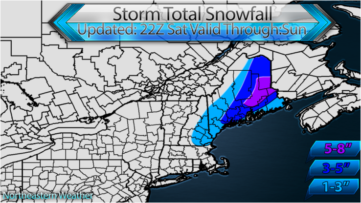
The part that everyone has been waiting for. Yes, there's gonna be snow. And in some cases, kinda a lot of it. While exact details are yet to be worked out, it is looking possible for a good 3-5" of snowfall to occur over interior Downeast Maine, with lighter amounts for other parts of Maine. Here's my storm snowfall forecast:

 RSS Feed
