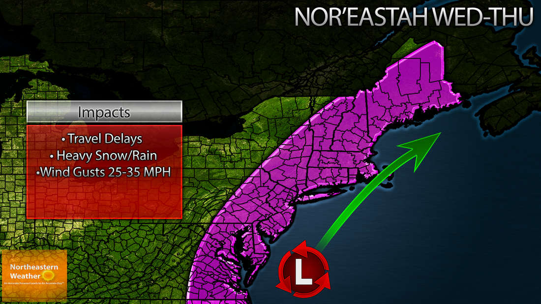
Of course the title is sarcasm. A nor'easter is set to rip up the northeastern coast of the United States Tuesday night through Wednesday into Thursday. Impacts on travel will be annoying or even devastating to some people trying to get to major areas along the i95 corridor.
I'm more confident in this forecast than I was last night, but things could still change, especially along the coast, so stay tuned!
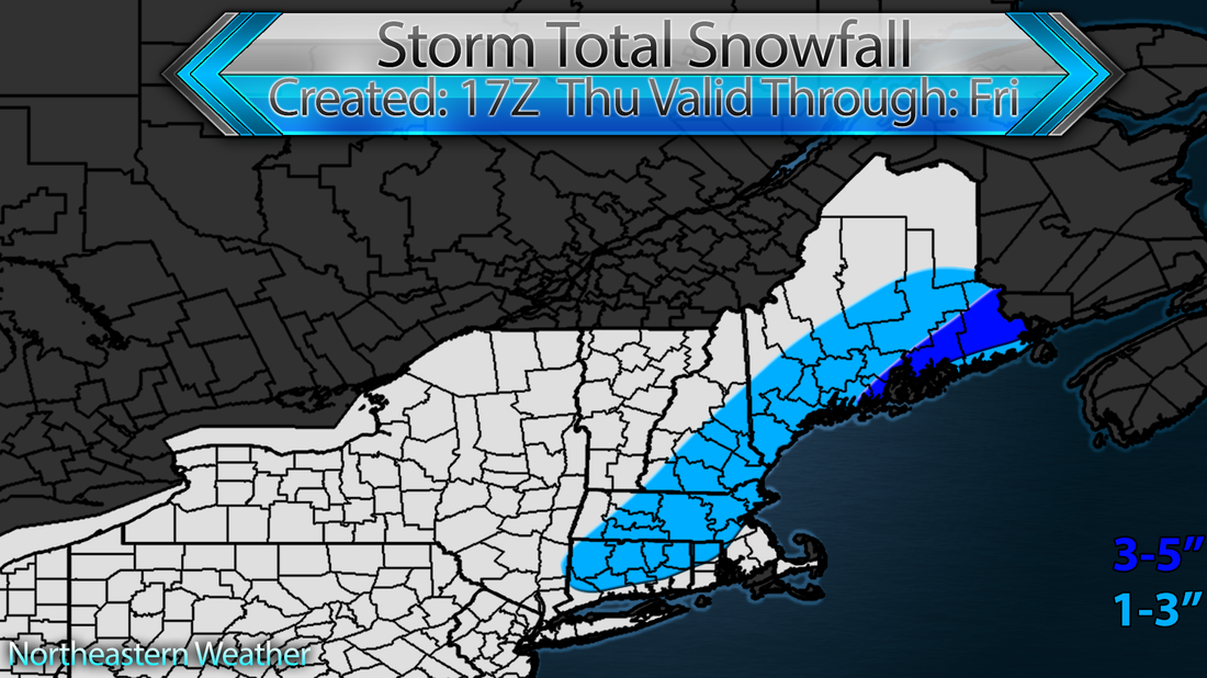
On Tuesday low pressure will form near the coast of the Carolina's. This low will lift north Tuesday night, carrying moisture (some tropical) with it. Continuing the moisture part, the system has PLENTY of access to Atlantic moisture, because it is what's called a nor'easter. A nor'easter is basically any storm that travels to the northeast and has a northeast wind direction. What this northeast wind direction essentially allows is for moisture to be carried on the east side of the storm and thrown back on to the coasts, in this case into cold air, causing snowfall. Have a look at the map below, and see if your region will be among the most impacted in the Northeast:
I'm more confident in this forecast than I was last night, but things could still change, especially along the coast, so stay tuned!
On Tuesday low pressure will form near the coast of the Carolina's. This low will lift north Tuesday night, carrying moisture (some tropical) with it. Continuing the moisture part, the system has PLENTY of access to Atlantic moisture, because it is what's called a nor'easter. A nor'easter is basically any storm that travels to the northeast and has a northeast wind direction. What this northeast wind direction essentially allows is for moisture to be carried on the east side of the storm and thrown back on to the coasts, in this case into cold air, causing snowfall. Have a look at the map below, and see if your region will be among the most impacted in the Northeast:
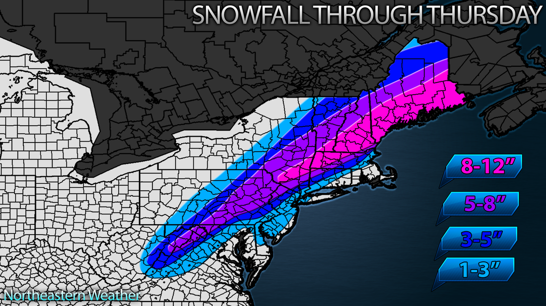
Now let's get to accumulations. Again I'd like to emphasize the word PRELIMINARY. I issued this map a bit ahead of time because of the fact that this storm is occurring on one of the busiest travel days of the year. Models are coming into better agreement on this, and I feel confident in saying that this system will NOT track out to sea. If anything, it'll track closer to the coast. The track closest to the coast would drive the heaviest snows farther inland than what I have. For now though, I'm going with a 1-3 for the i95 with less in the cities and more in the northern suburbs. The gradient will be high so I did best to put it up here. This is gonna be one of those storms where you go from 1-3 inches at the coast to 10-12 inches just inland. Winds will also gust to 35 MPH at the coast, not devastating but certainly enough to cause power outages with heavy, wet snow.
Alright, I'm gone for now. I'll update this later in the day and make changes if need be.

 RSS Feed
