
Severe Weather Outlook
Updated: 5 AM Sun Jun 14 2015
Today: A risk of severe thunderstorms exists across portions of western upstate NY, and most of PA.
Updated: 5 AM Sun Jun 14 2015
Today: A risk of severe thunderstorms exists across portions of western upstate NY, and most of PA.
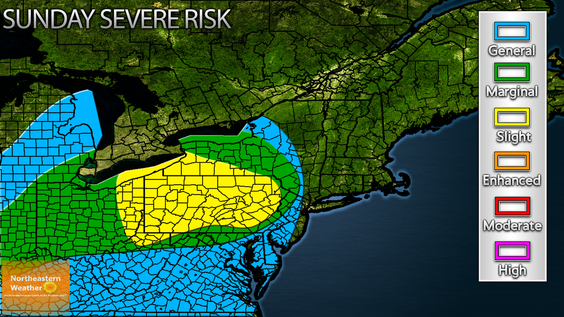
A slight risk of severe thunderstorms exists today across much of Pennsylvania, into western upstate New York. A subtle area of low pressure will move into the great lakes region today. Storms are already ongoing across much of southern Michigan this morning as a pretty strong low level jet noses into the area. A moist southwest flow will continue to advect very warm and humid air into the region as well. Afternoon CAPE values across portions of Ohio/PA will approach 1500-2500 J/kg, which should be sufficient to strengthen this area of convection as it moves into eastern Ohio, by 14-16Z or so. The result will likely be a line of storms, beginning in eastern Ohio, and tracking eastward. While subtle weakening/strengthening trends are likely as the line of storms progresses through the afternoon, overall, expect the line to hold together as it moves into eastern PA after 20Z. Currently thinking that the line will then slowly diminish, or atleast fan out into showers/iso storms capable of gusty winds, as CAPE values drop off sharply after reaching the NJ state border. This area of storms will then move eastward, and while no severe weather is expected overnight, isolated flash flooding will be possible across portions of NY, VT and west CT.
Looking ahead, another severe weather outlook will likely be needed for Monday 6/15, and possibly for Tuesday 6/16.
-Alex Reed
Looking ahead, another severe weather outlook will likely be needed for Monday 6/15, and possibly for Tuesday 6/16.
-Alex Reed
