Most major models are now in agreement in the rapid strengthening of low pressure off the Carolina coast on Monday, before the low tracks northeast on Tuesday and Wednesday, bringing a significant snowfall to much of the area. Various impacts are talked about below:
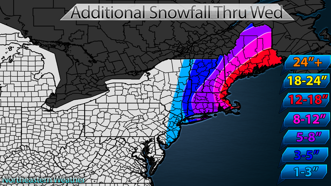
Snowfall totals are tough with this one. Cold air will hang tight in New England, making for snowfall totals around 1:15 (1 inch of liquid equals 15 inches of snow). Given this, my snowfall amounts range from 12-18 inches for much of the area, with 12-24 inches expected for much of New England. Over 2 feet is forecast for portions of Southern New England. The map below reflects what has already fallen, and what can be expected on top of that. Updated: 11 AM Tuesday.
Snowfall totals are tough with this one. Cold air will hang tight in New England, making for snowfall totals around 1:15 (1 inch of liquid equals 15 inches of snow). Given this, my snowfall amounts range from 12-18 inches for much of the area, with 12-24 inches expected for much of New England. Over 2 feet is forecast for portions of Southern New England. The map below reflects what has already fallen, and what can be expected on top of that. Updated: 11 AM Tuesday.
Timing looks to be tricky, with most models bringing in the snow to start in areas south of NYC as early as Monday afternoon, and lasting as long as Tuesday night. Areas north of NYC could see snow as early as overnight Monday and lasting as long as mid-day Wednesday. Timing of these systems changes easily though, so it's another thing to stay tuned on.
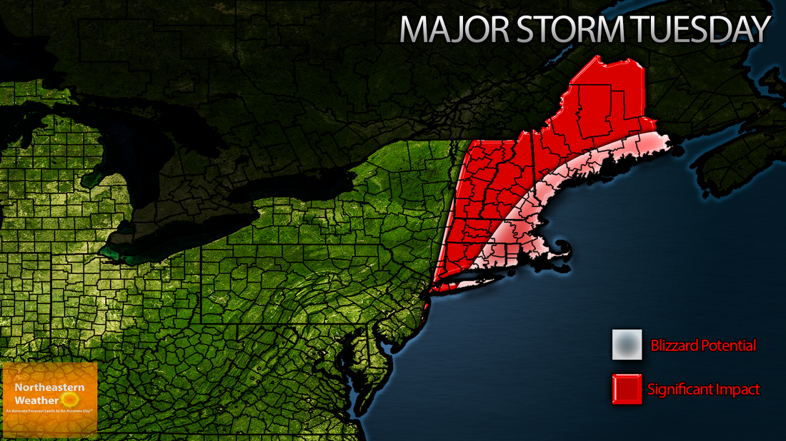
Wind is also a forecast challenge. At this point, gusts to 45 MPH are likely along the coast. As you've probably heard, the potential does exist for blizzard conditions across much of the Northeastern coastline. I currently expect blizzard conditions across the New England coastline, with the potential there on eastern Long Island and the New Jersey coastline. A lot of it depends on how light/fluffy the snow is, which is why New England is the highest-confidence for blizzard conditions at this point.
Overall I do expect a rather significant winter storm to impact much of the Northeast Monday through Wednesday, and the map below does reflect that. Stay tuned though, as details do change with these systems. -Alex Reed
 RSS Feed
